2010年1月13日 星期三

Prototype 3.0: Paris Je T'aime


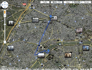
Combine Streetview video and YouTube video together. File format has been setup as 720p so that's enough for two separated windows. In the presentation, I supposed to display in three different windows. Like the picture shown below.


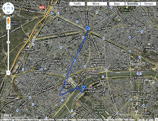
However, the photo section and the streetview section are too similar and it's too crowded put three windows in the same screen. Hence, I decide to decrease the photo part and display in only two windows. It's just like the prototype 3.0 now.

YouTube Doubler

YouTube Doubler. Just Find this interesting website on my friend's facebook today. User can combine two YouTube videos together and play them at the same time. It's kind of like the online vision jockey program. Really fun and innovative. I also combine my streetview video and YouTube one together. Below is the combination.

YouTube Doubler

(Because the width is not enough for two videos, please click the link and see the complete video)

Prototype 2.0: Paris Je T'aime (YouTube Clips)


One function of Google maps is that photos and videos can be tagged on maps, so when user clicks on photo or video function, Google maps will show the previews of photos and videos. Based on this function, the next step to develop this Intermedia practice is to combine the original video which is made by Google earth and streetview with the video made by YouTube videos.

First of all, I select the tagged videos from Google maps.


Then, I download these videos by a software called "MacTube" from YouTube website and covert them into quicktime movie format therefore I could import files and edit them in Final Cut Pro. After editing and adding some simply effects, the final work is done as below.

2010年1月2日 星期六

Prototype 2.0: Paris Je T'aime (Google Earth+Streetview)


During the Christmas vacation, I have done my new prototype 2.0 and named it "Paris Je T'aime" (same name as a movie). The reasons I choose Paris as my city to make prototype 2.0 is based on the following reasons:
1. Google gets both maps and street view web services in Paris. This might be the most important reason I chose Paris. Without Google street view and maps, my project will not be achieved.
2. I attempt to tribute to my inspiration, the photo set of Michael Wolf.
3. Though Paris and London is only separated by English channel. However, it is faraway for me because of visa and I could not attend there whenever I want like others.
4. I have only been Paris once when I was ten and memories of the city is almost gone. For that reason, Paris is always fascinating for me.


I choose the route from Arc de Triomphe to Eiffel Tower, the two most representive buildings and sightseeing spots in Paris, because I want to present the video as a journey video which is taken by tourist. The length between these two places is approximately 2.6 kilometers. Normally it takes five minutes by vehicle.

In this prototype practice, I try to combine two Google programs - street view and earth together. Capture the pictures from both software and website and put pictures in Final Cut Pro and convent into film format. Another attempt I try to achieve is that I add the frame rates a little bit (8 frames/per second) to make it less like a smooth video but a rough film. Here is the prototype two video "Paris Je T'aime".


In this one minute and thirty-five seconds video, there are approximately 350 pictures being used in it. However, my friend and I both feel it too plain and the pace is slow. I think in next version of prototype, I need to try some different elements like pause or reverse and also adjust the frame rates to see if it is suitable or not.

Google Earth


Google Earth is a virtual globe, map and geographic information program that was originally called EarthViewer 3D. It displays satellite images of varying resolution of the Earth's surface, allowing users to see things like cities and houses looking perpendicularly down or at an oblique angle, with perspective. The degree of resolution available is based somewhat on the points of interest and popularity, but most land (except for some islands) is covered in at least 15 meters of resolution.

For large parts of the surface of the Earth only 2D images are available, from almost vertical photography. Viewing this from an oblique angle, there is perspective in the sense that objects which are horizontally far away are seen smaller, but of course it is like viewing a large photograph, not quite like a 3D view.

For other parts of the surface of the Earth 3D images of terrain and buildings are available. Google Earth uses digital elevation model (DEM) data collected by NASA's Shuttle Radar Topography Mission (SRTM). This means one can view the Grand Canyon or Mount Everest in three dimensions, instead of 2D like other areas. Since November 2006, the 3D views of many mountains, including Mount Everest, have been improved by the use of supplementary DEM data to fill the gaps in SRTM coverage.

Many people use the applications to add their own data, making them available through various sources, such as the Bulletin Board Systems (BBS) or blogs mentioned in the link section below. Google Earth is able to show all kinds of images overlaid on the surface of the earth and is also a Web Map Service client. Google Earth supports managing three-dimensional Geospatial data through Keyhole Markup Language (KML).

Google Earth has the capability to show a 3D buildings and structures (such as bridges), which consist of users' submissions using SketchUp, a 3D modeling program. In prior versions of Google Earth (before Version 4), 3D buildings were limited to a few cities, and had poorer rendering with no textures. Many buildings and structures from around the world now have detailed 3D structures; including (but not limited to) those in the United States, Canada, Ireland, India, Japan, United Kingdom, Germany, Pakistan and the cities, Amsterdam and Alexandria.